Your Cutting Edge 3D Laser Scanning Service Provider
Laser Scanning
Services
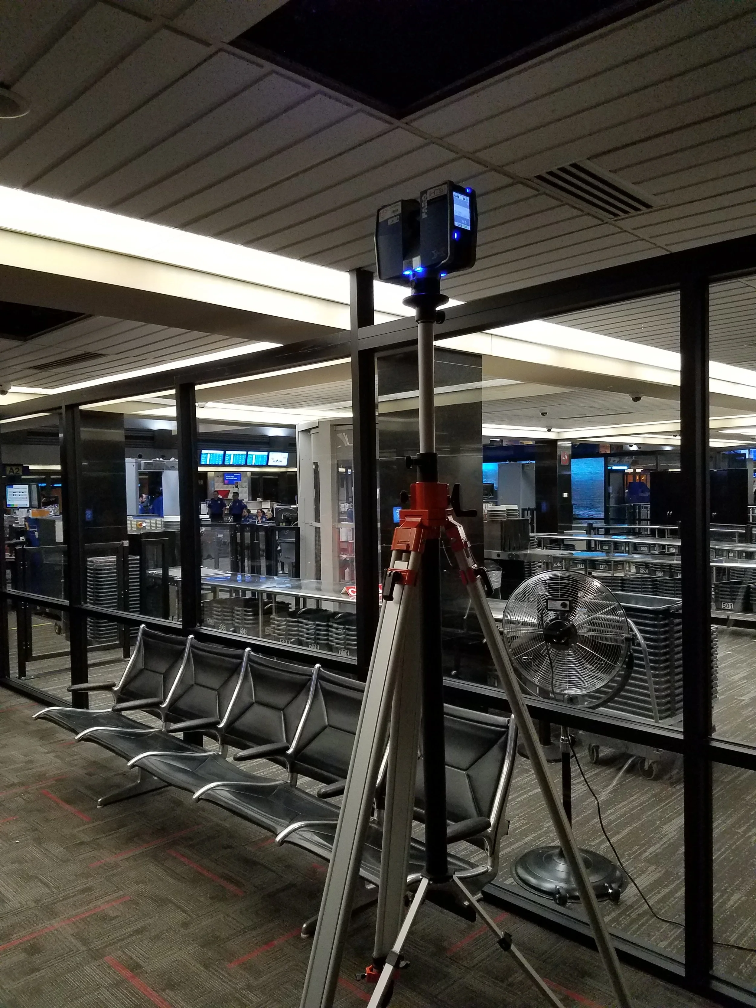
Our teams will travel to your location to collect laser scans of your project using the latest technology ensuring accuracy and clean datasets.
Once complete, the data is processed and can be delivered as a point cloud for use in CAD, Revit, or as an E57 file for use in other platforms.
200 color scans on average can be collected per day. Daily rates start at $4,500.
Clash Detection
Provide us with your design model in Revit or CAD, then we can compare your model to our current point cloud and look for conflicts.
We can create 3D simulations showing the movement of heavy equipment through a building or plant, ensuring clearances.
Save time and stress knowing your design is conflict free.
3D/2D and Metadata extraction from point clouds
Do you have point clouds and need 3D models or 2D drawings extracted? Our team will get the information you need. We can model a whole building or plants based on electrical, mechanical, fire protection, structure, and architectural elements. To save money, tell us only what you need. Point clouds can be mined for data at any time.
Analytics/ Reporting
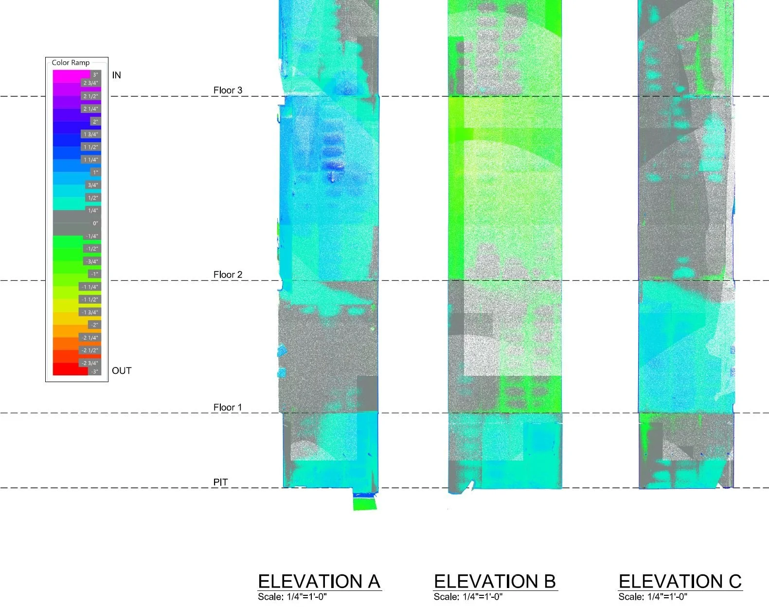
Every deliverable is not a 3D model. Sometimes information is simply a heat map illustrating floor flatness or verifying construction versus design.
Laser Scans have been used to track expansion and contraction of mechanical components while under load, compared to an outage.
Other deliverables have been created verifying mounting points for new equipment that will be manufactured off site.
At times, the point cloud is simply needed for an as built record or digital t.
Let us know your needs and we will find a solution.
Training
Is your team ready to use point clouds directly for your firms own needs? We are open to showing clients how to leverage this technology, with the idea for your team to save time and money. Our goal is to see this technology move forward, sharing ideas, and create relationships.

